OffTheGrid revisited
Add comment!June 2nd, 2009
What is OffTheGrid terrain?
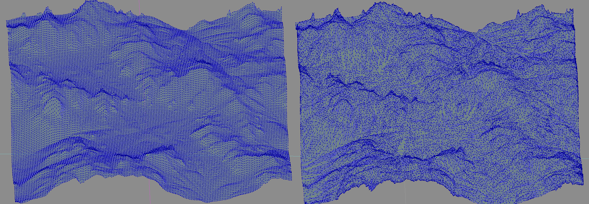
OffTheGrid is a terrain technology we developed to bring detailed terrain data to in-game resolution without losing much detail. Below you can see a comparison between heightmap terrain (left), and OTG terrain (right). The OTG terrain is actually using fewer polygons.

How does it work?
We start with a high-polygon terrain, and iteratively discard the least important polygon edge (as defined by Dr. Michael Garland's quadric-based polygonal surface simplification algorithm) until we get down to our in-game polygon count target. We then apply the normals and color map from our high-polygon terrain onto our simplified mesh. Here is a wireframe image showing how OTG terrain uses less polygons by choosing them more carefully.
Why do we care?
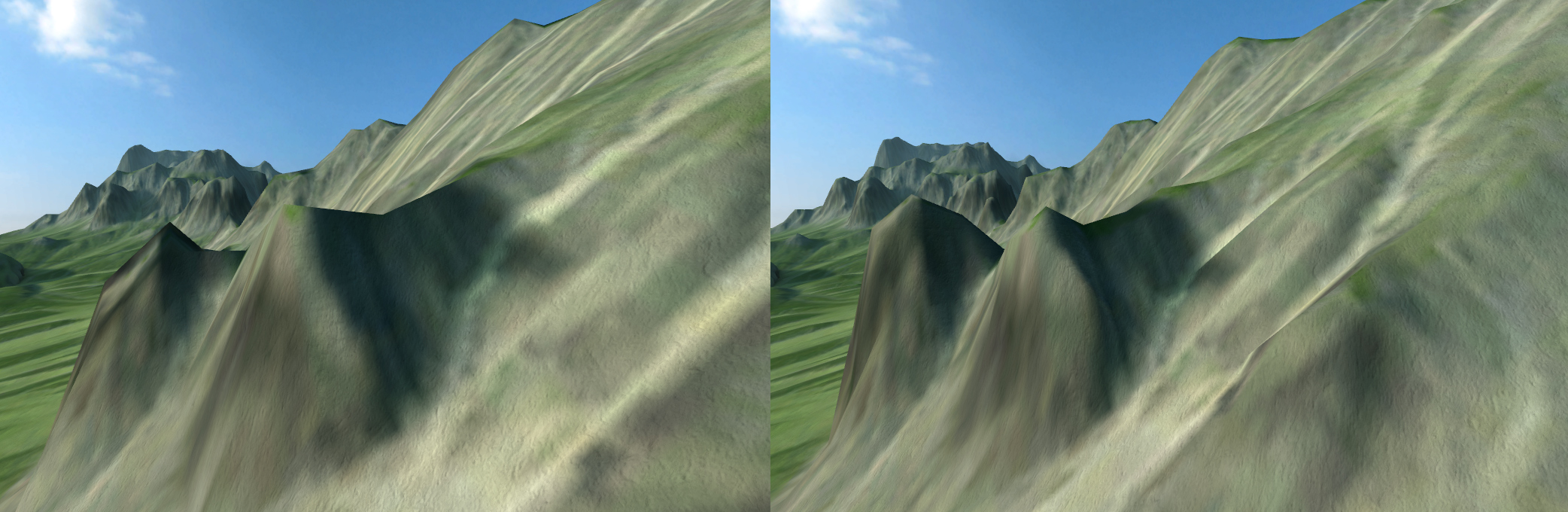
With traditional heightmap terrain, it is only possible to accurately represent soft, rolling hills - small details like rivers, sand dunes, and cliff faces are all smoothed away by the grid. Using OffTheGrid terrain will allow us to portray a much wider variety of environments than we could with heightmap terrain. Here is an example of a small mountain detail that is destroyed by the grid (left). Please keep in mind this is just our base terrain mesh -- we are going to add vegetation, detail maps, and other environmental detail on top of this.
Now that we have an effective technique to create an efficient base mesh, do you have any other ideas for how we can improve our terrain? I have a few ideas, but I'm not sure which is the most important.